AlistoEncore Operating System • Integrated Modules

One Connected Platform for Municipal Operations

AlistoEncore unifies command AI, environmental risk monitoring, geospatial planning, citizen SMS alerts, and system management into one cohesive local-government intelligence matrix.
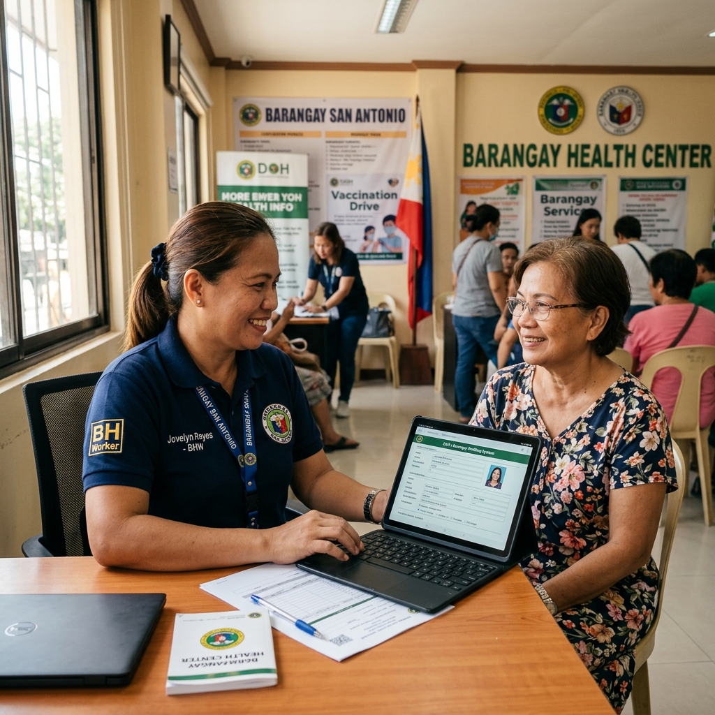
Built For: Mayors City Administrators DRRMO Leaders Department Heads IT Decision-Makers Implementation Partners
General System Architecture

General System Functionality & Operations

Watch how ENCORE connects municipal command centers, field responders, environmental telemetry, and citizen reporting in real-time.

Data Pipeline

How Data Moves Across Encore

Encore is not a disconnected set of dashboards. Information flows seamlessly from environmental monitoring to decision qualification, early warning action, and audited governance.

STAGE 01

Monitoring

Continuous ingestion from radar feeds, weather stations, satellite models, barangay hazard entries, and SMS citizen report pins.

Open-Meteo PAGASA Radar Barangay Hazards GPS Pins
STAGE 02

Decision

Threat Monitor qualifies risk levels. AIGOR AI provides conversational briefings. Plot Management compiles PDRA risk assessments.

AIGOR Command Threat Monitor PDRA Generator Exposure Models
STAGE 03

Action

Operators verify evidence and dispatch scoped alerts across SMS Shortcodes, Emergency Cell-Broadcast, Email, and official social channels.

SMS Gateway App Push Facebook Auto-Post Scoped Warning
STAGE 04

Audit & Governance

Every alert, PDRA output, system maintenance log, and project milestone sign-off is stored in immutable audit logs and PDF archives.

System Logs Signatory Approval Immutable PDF Project Baseline

Alisto Intelligent Command Core

Conversational command intelligence powered by operational context awareness and automated triage.

Public Name: Alisto Command Intelligence Core

Alisto Command Core

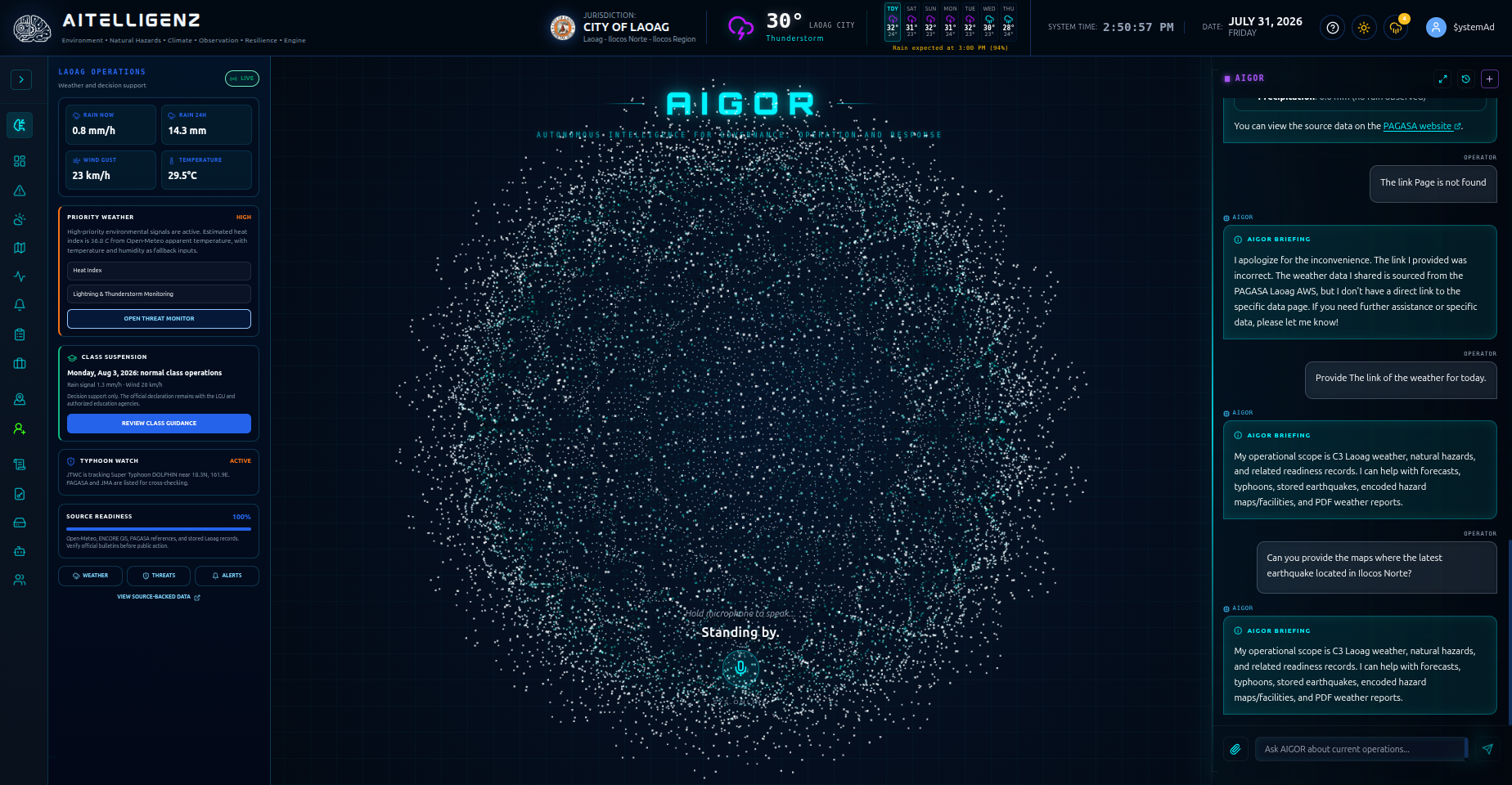
Ask operational questions, understand live context, and move from information to a clearer decision.
"Alisto Command Core gives command-center teams a conversational interface to live operational context. Ask about incidents, locations, environmental conditions, and response priorities—then see the relevant situation brought into focus."
  • Conversational Interface: Natural language processing tuned for command-center queries.
  • Active Context Awareness: Live incident and location focus on an interactive map.
  • Conversation Management: Saved, selectable, renamable, and deletable conversation history.
  • Voice Interaction: Speech input and text-to-speech voice output support.
  • Deterministic Fallback: Grounded environmental briefing support even when primary AI gateway is offline.
SYSTEM UI PREVIEW: Alisto Command Core Interface [Context Aware] [Voice Enabled]
Alisto Command Console UI Screenshot

WeatherCast AI Environmental Matrix

A connected environmental-intelligence workflow from monitoring to multi-channel dissemination.

Municipality / Barangay Dashboard

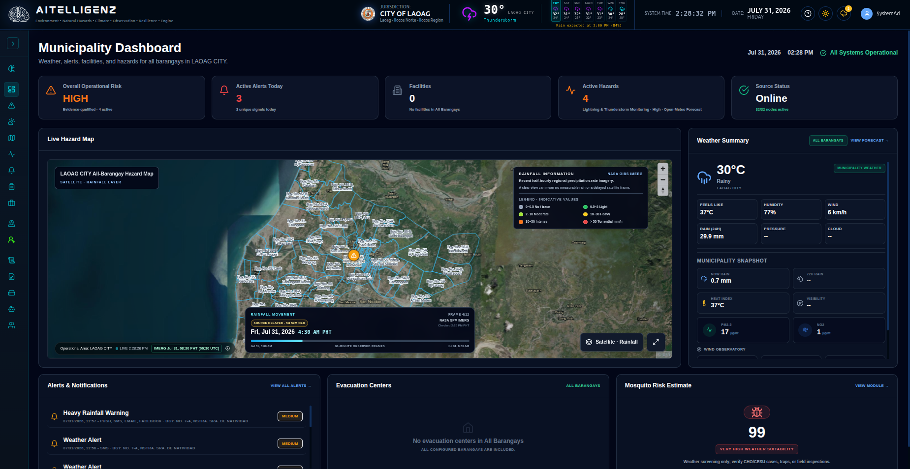
A local common operating picture for weather, alerts, facilities, hazards, and source readiness.
"See the conditions that matter to each municipality or barangay in one operational view—from active hazards and alerts to facilities, weather, source status, and local exposure."
  • Scoped LGU Views: Municipality-wide for administrators & assigned-barangay for scoped users.
  • Operational Risk Summary: Active alert and active hazard counts at a glance.
  • Facility Visibility: Evacuation centers, hospitals, fire stations, and water points.
  • Environmental Metrics: AQI, wind, heat index, and mosquito-risk estimate.
ACTUAL SYSTEM UI: Municipality Common Operating Picture
Municipality Dashboard UI Screenshot

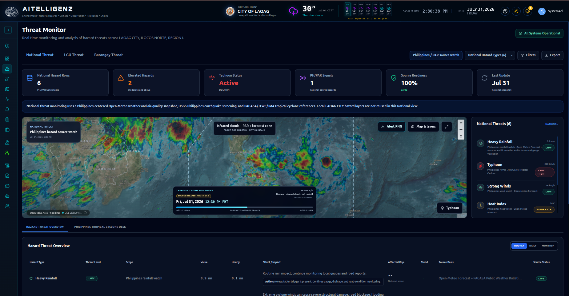
Threat Monitor

Continuously qualify environmental threats and highlight what requires attention first.
"Turn multiple hazard feeds into an evidence-qualified threat picture, with clear severity, affected areas, exposed population, source status, and recommended operator attention."
  • Real-Time Hazard Monitoring: Qualification of risk levels and priority threat counts.
  • Population Exposure: Estimates affected residents across barangays and districts.
  • PAR Monitoring: Philippine Area of Responsibility and national threat screening.
ACTUAL SYSTEM UI: Threat Monitor & Exposure Screening
Threat Monitor UI Screenshot

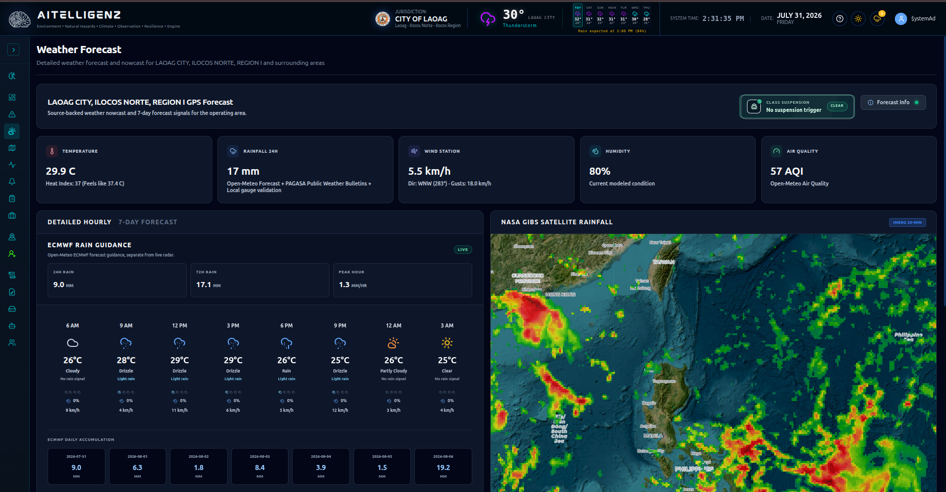
Weather Forecast

Detailed nowcast and forecast intelligence for the configured jurisdiction and surrounding areas.
"Move beyond a general city forecast with jurisdiction-aware nowcasts, rainfall outlooks, wind and heat conditions, and operational context for local planning."
  • Multi-Period Forecasting: Short-term nowcasts and 7-day outlooks.
  • Telemetry Metrics: Rainfall, heat index, humidity, wind, & atmospheric pressure.
  • Typhoon Tracking: Active PAGASA/JTWC tropical cyclone routing context.
ACTUAL SYSTEM UI: Weather Forecast Console
Weather Forecast Console UI Screenshot

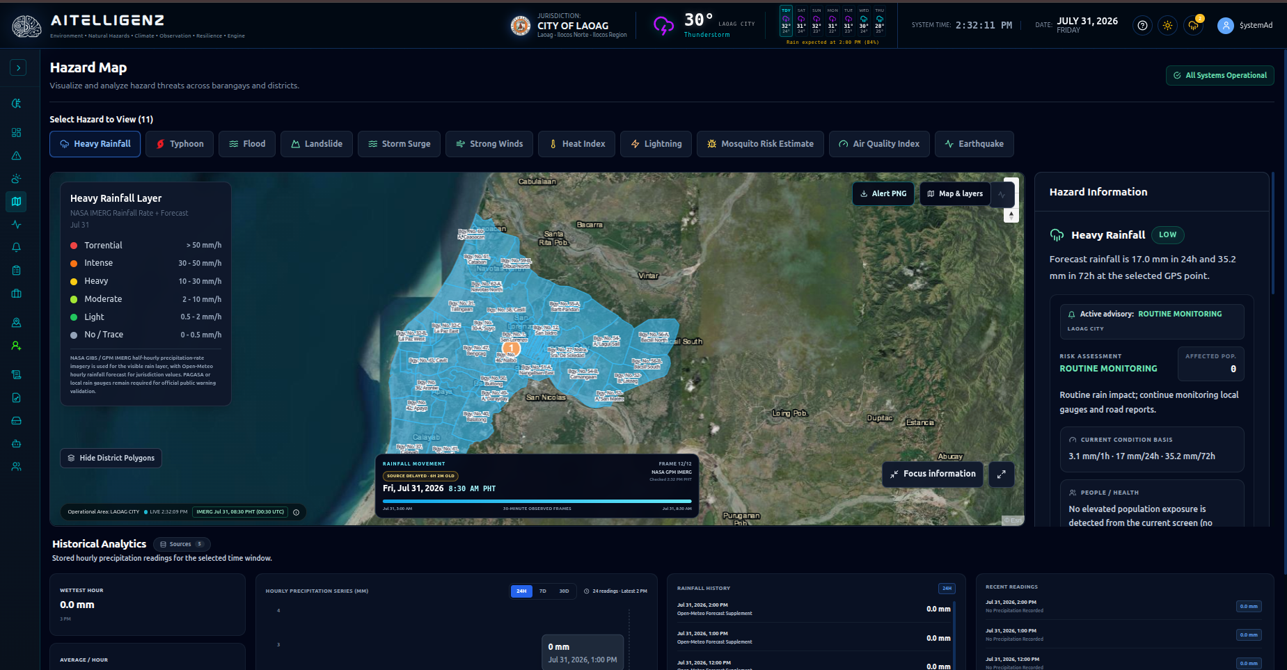
Hazard Map

Explore environmental threats spatially across barangays, districts, and the wider operating area.
"Understand where risk is developing. Encore combines localized boundaries, environmental layers, encoded field hazards, and exposure context in one interactive map."
11 Verified Hazard Layers:
Heavy Rainfall Flood Risk Landslide Risk Storm Surge Strong Winds Heat Index Lightning Earthquakes Mosquito Risk AQI Typhoon Track
ACTUAL SYSTEM UI: Spatial Hazard Map Layering
Hazard Map GIS Screenshot

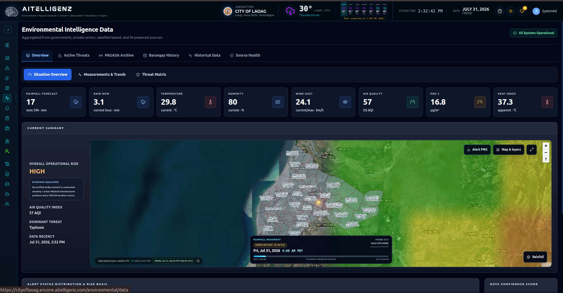
Environmental Intelligence Data

Inspect the evidence, thresholds, history, and source health behind the operational view.
"Make decisions from traceable evidence. Inspect current readings, risk bands, data history, and source health instead of relying on a black-box score."
  • Active Threat Table: Inspect numeric bands for rainfall, heat index, wind gusts, and AQI.
  • Source Aggregation: Government, private-sector, satellite-based, and marine advisories.
  • Historical Snapshots: Stored telemetry logs for post-incident audits.
ACTUAL SYSTEM UI: Traceable Telemetry Evidence & Source Health
Environmental Intelligence Data Screenshot

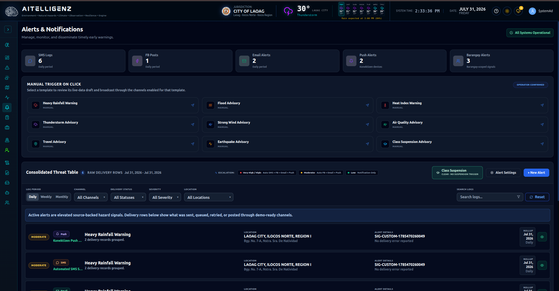
Alerts & Notifications

Prepare, disseminate, and audit early warnings across multiple public channels.
"Move from awareness to communication with scoped alerts, reusable templates, multi-channel delivery, and a traceable dissemination record."
Multi-Channel Path:
Threat Detected → Operator Verifies → Alert Approved → SMS / Email / Push / Facebook → Delivery Logged
  • Channel Support: Telco SMS Shortcode, Cell-Broadcast Alerts, Email, & Official Facebook auto-posting.
  • Barangay Scoping: Targeted warning signals down to specific barangay sectors.
  • Delivery Audit: Traceable delivery history and channel-level status reporting.
ACTUAL SYSTEM UI: Multi-Channel Alert Dissemination
Alerts Dissemination UI Screenshot

Planning & Governance

Manage municipal assets, pre-disaster risk assessments, and infrastructure project portfolios.

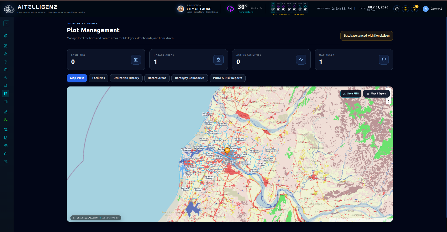
Plot Management

Maintain local facilities, hazard areas, boundaries, land-use plots, and planning evidence.
"Build and maintain the authoritative local map behind preparedness and response: facilities, utilization, hazard areas, boundaries, land-use records, and revision history."
  • Facilities Management: Creation, editing, mapping, generator/water/medical attributes.
  • Hazard Areas: Creation, editing, archival, and 'Mark Safe' workflow.
  • Geospatial Controls: Barangay boundary management, land-use plotting, & PNG map export.
Named Submodule Inside Plot Management

PDRA & Risk Reports

"Convert current conditions and local evidence into DRRMO-ready planning outputs, with configured signatories, controlled delivery, archived PDFs, and a generation audit trail."

  • PDRA Generation: Daily risk analysis & climate disaster risk assessment evidence.
  • Signatory Governance: Configured 'Prepared-by', 'Validated-by', & 'Approved-by' workflows.
ACTUAL SYSTEM UI: Plot Management & Spatial Boundaries
Plot Management Facilities Mapping UI Screenshot

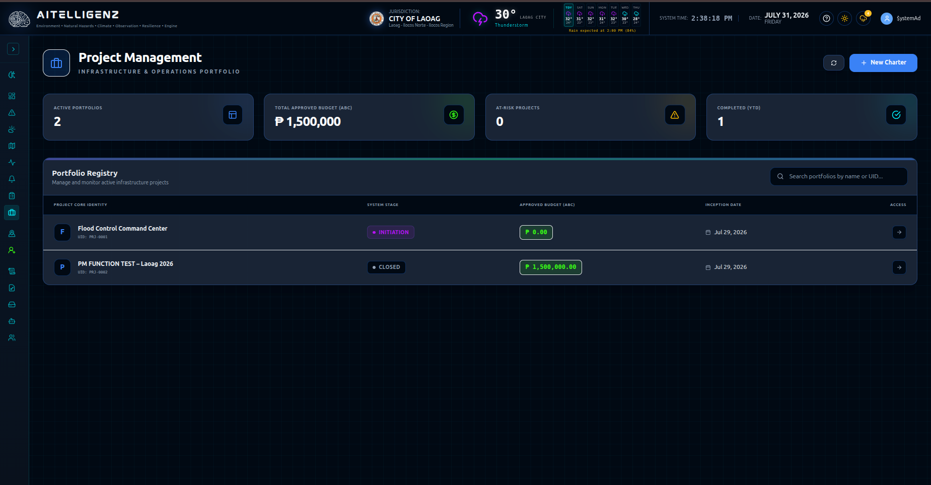
Project Management

Govern public-sector projects from charter and budget baseline through delivery, variance review, and sign-off.
"Give infrastructure and governance teams one structured record for project scope, responsibility, budget, work breakdown, progress, variance, and final sign-off."
  • Portfolio Registry: Active, at-risk, budget, and completion summaries.
  • Project Charter Portal: Sponsor, implementing office, legislative basis, funding source.
  • Financial Controls: Approved-budget breakdown, baseline locking, schedule/cost variance.
  • Sequence Projection: Gantt chart projections, active sprint Kanban, digital sign-off.
ACTUAL SYSTEM UI: Public Sector Project Governance
Project Management Governance Portal UI Screenshot

AlistoSMS & Civic Registry Platform

Two-way SMS emergency gateway, citizen engagement, spatial citizen pins, and LGU demographic awareness.

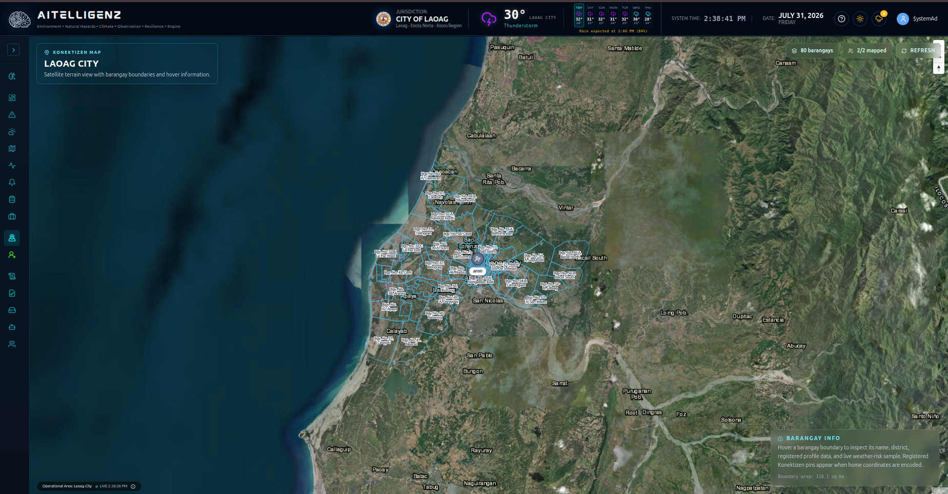
Alisto Civic Spatial Map

See citizen incident reports and registered citizen locations in geographic context while preserving the local barangay operating picture.
"Geographic context of registered citizens, SMS report origins, detected incident locations, and barangay population overlays."
  • Satellite & Boundary View: LGU barangay boundaries and high-risk hazard zone overlays.
  • Spatial Incident & Citizen Pins: SMS dispatch status, timestamp, & GPS location accuracy.
  • Selected Pin Focus: Real-time incident triage and dispatch responder routing.
ACTUAL SYSTEM UI: Civic Spatial Citizen Pins & Reports
Civic Map UI Screenshot

Alisto Civic Registry & SMS Gateway

Centralized citizen contact database and two-way SMS directory for LGU demographic awareness and emergency alerts.
"Maintain verified resident mobile contacts linked to barangays to ensure instant broadcast alerts and zero-data 2-way reporting."
  • Directory Management: Verified resident mobile profiles and emergency contact details.
  • Barangay Linkage: Geo-targeted resident registration by barangay sector and evacuation zone.
SYSTEM UI PREVIEW: Resident Directory & SMS Verification
Civic Registry UI Screenshot

System Management & Administration

Enterprise administration, audit logs, licensing, AI guardrails, and role-based security.

Logs Management

Centralized audit trail, system event logging, security tracking, and operator action audits.

Company License

Module activation, SLA status monitoring, municipality license validation, and capacity tracking.

System Maintenance

Backup & restore, database optimization, source health diagnostics, and service controls.

Command AI Configuration

Alisto Command AI gateway settings, deterministic fallback triggers, model parameters, & LLM guardrails.

User Management

Role-based access control (RBAC), barangay-scoped permissions, and multi-department policies.

Local Government Security

Built for High-Compliance LGU Operations

AlistoEncore delivers absolute data sovereignty, multi-signature approvals, and zero-cloud dependency options.

Self-Hosted / On-Premise

Deploy on local LGU servers. Operates independently of external cloud services for maximum resilience during major telecom outages.

Strict Barangay Scoping

Role-based access controls ensure barangay officials only view and edit their assigned operational jurisdiction.

Signatory PDF Audit

PDRA assessments and project milestones generate immutable PDF records with configured prepared-by, validated-by, and approved-by signatures.

Ready to See AlistoEncore in Action?

Schedule a live, interactive demonstration tailored for your municipality's command center and disaster management team.

SCHEDULE LIVE DEMONSTRATION